Use the colour code to add a landform to each name. For instance, ‘Tibetan plateau'. Class 6
mediumUse the colour code to add a landform to each name. For instance, ‘Tibetan plateau'. Class 6
Let us Explore (Page 53)
Question 1.
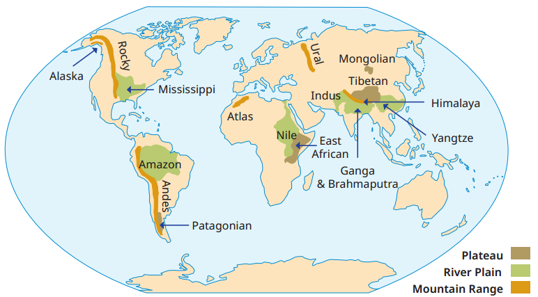
Use the colour code in Fig.(given in Textbook) to add a landform to each name. For instance, ‘Tibetan plateau’, ‘Rocky range’, ‘Nile plain’. (You do not have to remember the names in this map.) Class 6
Answer:
Mountain range: Alaska Range, Rocky Range, Andes Range, Atlas Range, Ural Range and Himalayan Range.
Plateau: Patagonian Plateau, East African Plateau, Tibetan Plateau and Mongolian Plateau.
River Plain: Mississippi Plain, Amazon Plain, Nile Plain, Indus Plain, Ganga and Brahmaputra Plain and Yangtze Plain.
Let us Explore (Page 54)
Question 2.
The picture in Fig.(given in Textbook) has been taken from a satellite. It captures a portion of north India from a high altitude. Observe and discuss the image as a class activity. Class 6
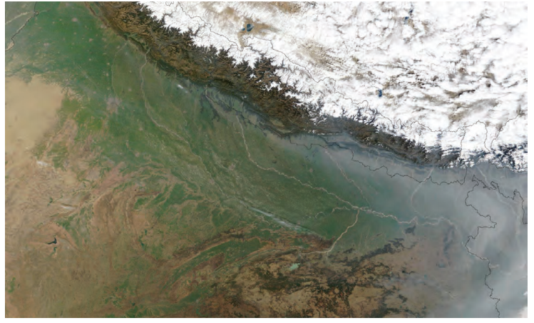
- Which colour is the Ganga plain?
- What does the white expanse represent?
- What does the brown expanse at the bottom left of the image represent?
Answer:
- The Ganga plain is shown in green colour.
- The white expanse represents snow or ice-covered areas of Himalayan mountains.
- The brown expanse at the bottom left represents Thar Desert or dry land.